R. Luke DuBois is an artist, composer, and engineer that works with data and algorithms. Similar to the methods today’s corporate market collects data on their target demographics through the ways the consumer interfaces with digital tools and social media, DuBois collects data to explore the ways in which the globalized social body connects.
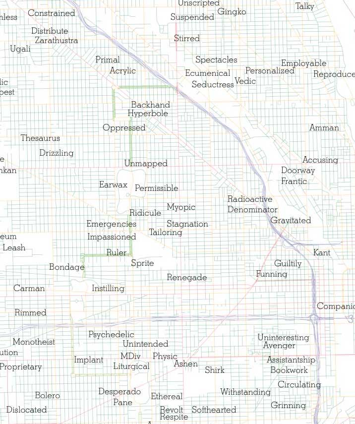
In his 2011 project A More Perfect Union, DuBois collected user-inputted data from millions of online dating profiles throughout the US across several digital platforms. After indexing the data by its zip code and vocabulary, DuBois created maps that plotted US cities and regions by the most-used unique words in their collective online dating profiles. These maps could be organized in a variety of ways: individual words nationwide, unique words by state or by city, as well as accounting for words by gender. For the state of California, Los Angeles was plotted as ‘Acting,’ San Francisco as ‘Gay,’ and San Diego as ‘Connect.’ Salt Lake City is ‘Mormon,’ Seattle is ‘Heartbreak.’ In Illinois, Chicago was plotted as ‘Always.’ Adjusting the data to map words on a smaller scale, the city of Chicago gets broken down into many smaller unique words. I currently live somewhere between ‘Oppressed’ and ‘Unmapped.’
Through A More Perfect Union, DuBois is considering user-input to inform, or refract, objectified data from a global nervous system. He maps human connectivity through digital correspondence, creating a geographical aerial view of the now-visible social body.
These maps are only virtual. They exist in a digitized space in which the viewer looks down as if embodying a floating, god’s-eye camera. That virtual ground is generated from data that is transient – it moves, can be adjusted and manipulated, projecting only an incorporeal, unstable ground. The top-down global views of our data give us a widely observable and traceable network of our interconnectivity, though they shift the perspective of the viewer from the horizontal, grounded landscape view to a suspended, floating and falling aerial view of the ever-shifting ground. These new social maps, with their top-down cartography of the global social body, illustrate the ubiquity of post-foundational networks.